LENGTH
17 mile loop
ELEVATION
5,000 feet
DIFFICULTY
Hard
SEASON
Spring and Fall
PERMITS
TRAILHEAD
From 7,000 feet high on the South Rim to the Colorado River, there's no shortage of spectacular scenery on this bucket-list worthy backpacking adventure in Grand Canyon
National Park.
The best time of year to backpack the Grand Canyon is during the spring and fall, when the temperatures are more mild. The summer is dangerously hot, while snow and ice can be experienced during the winter. Note that the weather can be unpredictable at any time of the year.
Backpacking the Grand Canyon requires a little planning; including reserving permits (or attempting walkups), and packing accordingly. Check our guide below for details on planning your Grand Canyon trip!
Backpacking Permits
A permit is required for all backcountry camping in Grand Canyon National Park. There are two types of permits available to prospective campers, Advance and Walk-up permits. We'll cover both of these permit types below.

To increase your odds of being selected for a backcountry permit, add a variety of possible itineraries and dates to your application.
When your number gets called, you'll be awarded a permit to hike the next day. Because of this system, I recommend spending 3-4 nights at the South Rim to have a good chance at securing a walk-up permit. It took us two nights to get ours, but we got a little lucky - another camper was willing to share their site with us, pushing us up a couple places in line.
This is the general flow of getting a backcountry permit using the walk-up system:

Advance Permits
The National Park Service releases most backcountry permits via an write-in reservation system. To apply, follow the backcountry permit instructions provided by the park service, mailing your request up to four months in advance of your trip.To increase your odds of being selected for a backcountry permit, add a variety of possible itineraries and dates to your application.
Walk-up Permits
For walk-up permits, show up to the backcountry office at least two days before you intend to backpack to inquire about permits. If permits are sold out (they typically will be), the rangers will give you a wait-list number. Return at 8AM the next day and wait for your number to be called. If your number is not called, you'll get a new wait-list number, and may try again the next day.When your number gets called, you'll be awarded a permit to hike the next day. Because of this system, I recommend spending 3-4 nights at the South Rim to have a good chance at securing a walk-up permit. It took us two nights to get ours, but we got a little lucky - another camper was willing to share their site with us, pushing us up a couple places in line.
This is the general flow of getting a backcountry permit using the walk-up system:
- Reserve around three nights at the Mather Campground, or at another nearby facility. This will be your base camp while waiting for a walk-up permit.
- When you arrive at the South Rim, stop by the backcountry office and get a wait-list number. The earlier in the day you arrive, the better (office opens at 8AM).
- The following morning, go to the backcountry office just before 8AM with your wait list number. If the permits sell out before your number is called, you'll receive a new number and may re-apply the next day.
- Permits are valid the day after you receive them, meaning you'll generally have a couple days to kill at the South Rim.
Hike Info
Trailhead and Access
While this trip can be done many ways, I recommend starting your backpacking trip at the South Kaibab Trailhead and hiking to Bright Angel Campground near the Colorado River for at least one night. For the return hike, take the Bright Angel
trail back up to the Bright Angel Trailhead.
Access between the two trailheads is faciliated by the South Rim Shuttle bus system, a free shuttle that goes all around the rim. You can park your car overnight at the backcountry office, and use the bus system to get to the South Kaibab Trailhead.
Access between the two trailheads is faciliated by the South Rim Shuttle bus system, a free shuttle that goes all around the rim. You can park your car overnight at the backcountry office, and use the bus system to get to the South Kaibab Trailhead.
South Kaibab Trail

The South Kaibab Trail is an otherworldly, extremely beautiful trail with scenic vistas and red rock at every turn. You will see spots of wildflowers in the spring, and many gorgeous rock formations as you descend 5,000 feet and 7 miles to the Colorado River.
Be aware that there is no water on this trail, and almost no shade - pack more water than you think you will need. The temperature will increase as you descend, being 20-30F warmer at the bottom than the rim. A general rule of thumb is that for every 1000 feet of elevation you lose, the temperature will go up 5 degrees.
After an amazing hike down the South Kaibab Trail, you'll arrive at the Colorado River. Pass through a tunnel and across a bridge, and hike the remaining 1/2 mile to Bright Angel Campground. Depending on the time of year, it may be intensely hot through this section by the river - thankfully, there is a water station not far from the bridge crossing to refill and cool off by.

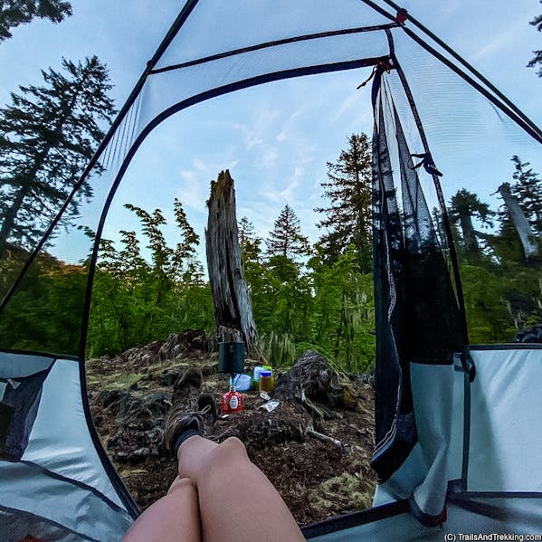
Bright Angel Campground
Located in a canyon alongside Bright Angel Creek, the campground is up and slightly away from the Colorado River. When you arrive, choose an unoccupied site
and place your permit in the drop-box. Each site has a picnic table, a backpack hang, and a metal box for food storage. Make sure not to leave any food out,
as the local squirrels are hungry!
Despite being in the backcountry, this is a developed campground. There are restrooms and potable water, but note that it's still recommended to bring a water filter in case of emergency.
If you continue walking past the campground, you'll arrive at Phantom Ranch, where drinks or snacks can be purchased (cash or card accepted). Phantom Ranch is a historic hotel which originally opened in 1922. The North Kaibab Trail starts after Phantom Ranch, climbing up until it eventually reaches the North Rim some 14 miles away.
Bright Angel Trail
The Bright Angel Trail is the best way to hike out of the Grand Canyon, with multiple rest houses and places to refill your water, like Havasupai Gardens.
While longer than the South Kaibab Trail, there's more shade, water, and the grade is less steep (though still extremely steep).

From Bright Angel Campground, the trail starts by crossing a suspension bridge, and follows the Colorado River for a ways. From the river, it's 9.5 miles and 4,500 feet of gain to reach the South Rim. Enjoy endless switchbacks as you traverse up from the river, taking plenty of time to enjoy the views during your ascent. It's a stunning trail, and well worth the effort.

This is the most popular trail in the Grand Canyon, and the crowds get thicker the closer you are to the top. You're also likely to see mule trains on their way up or down the canyon, carrying supplies or boarders bound for Phantom Ranch. Make sure to give the mules right-of-way when you're hiking.
From Bright Angel Campground, the trail starts by crossing a suspension bridge, and follows the Colorado River for a ways. From the river, it's 9.5 miles and 4,500 feet of gain to reach the South Rim. Enjoy endless switchbacks as you traverse up from the river, taking plenty of time to enjoy the views during your ascent. It's a stunning trail, and well worth the effort.
This is the most popular trail in the Grand Canyon, and the crowds get thicker the closer you are to the top. You're also likely to see mule trains on their way up or down the canyon, carrying supplies or boarders bound for Phantom Ranch. Make sure to give the mules right-of-way when you're hiking.

More Info
Start Hiking Early
It gets hot in the Grand Canyon, even during springtime. Seriously hot. Starting as early as you can will help limit hiking during the hottest part of the day,
from 10AM to 4PM. Pack plenty of water, electrolytes, and salty snacks help your body accommodate the loss of fluids from hiking in hot weather.
A good way to stay cool during hot days is by immersing yourself in water a creeks and rest stops - really soak yourself, so evaporation will keep you cool.
The Grand Canyon shuttle busses typically start before dawn, allowing you to reach the trailhead for an early start.

The Grand Canyon shuttle busses typically start before dawn, allowing you to reach the trailhead for an early start.
Prepare accordingly
Hiking down to the Colorado River is an amazing experience, but also one that should not be taken lightly. This is a difficult trail, and is known for having many
rescues every year. Check out the NPS Hiking Guide for more information on hiking the Grand Canyon.

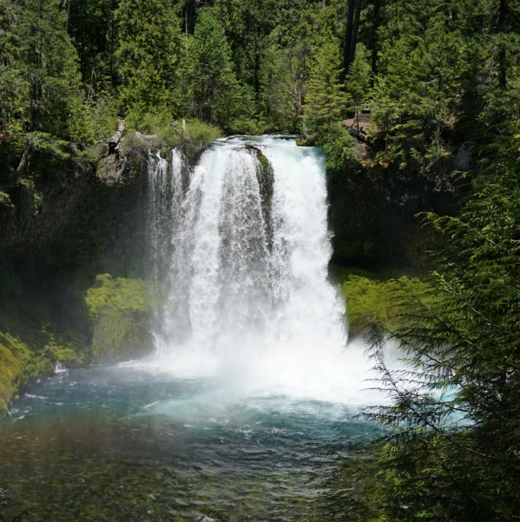
Ribbon Falls Hike
If you're staying more than one night at Bright Angel, I recommend spending a day hiking the North Kaibab Trail up to Ribbon Falls. It's 13 miles
round-trip to Ribbon Falls, and every step of the way is through spectacular red rock canyons.
Best of all, it's a relatively flat hike to Ribbon Falls, gaining only 1,200 feet over the 13 mile round-trip.
The Ribbon Falls day hike was the highlight of our trip to the Grand Canyon, chock full of spectacular scenery and wildflowers. Start your hike early to enjoy the best views: later in the day, the sun glare will wash out color from the beautiful rock walls.


The Ribbon Falls day hike was the highlight of our trip to the Grand Canyon, chock full of spectacular scenery and wildflowers. Start your hike early to enjoy the best views: later in the day, the sun glare will wash out color from the beautiful rock walls.
What to Pack
Backpacks
Shelter
- backpacking tent
- sleeping bag
- sleeping mat (women's), sleeping mat (men's)
- pillow
- tent lights

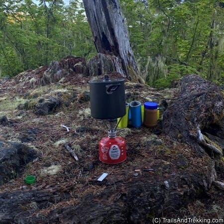
Camp Kitchen
- kitchen kit
- electric lighter
- spork
- pocket-knife
- water bottle
- squeeze filter bottle
- water filter
- un-flavored, un-sweetned electrolyte solution
- tasty camp dinner
- easy no-mess camp breakfast (discount code LAURENG for 15% off)

Toiletries
- Tooth brush
- Floss
- tooth paste tabs
- body & face wipes
- bug spray
- the BEST itch relief solution (I literally carry this everywhere during bug season)
- first aid kit

Utilities
- headlamp
- portable battery
- kindle e-reader
- Garmin GPS watch
- dry bag, stuff sack
- the best trail maps (better than Nat Geo's)

Clothing
- hiking boots (women's)
- trail shoes (men's)
- camp shoes
- hiking socks
- packable puffer
- women's hiking shorts
- men's hiking shorts
- women's hiking pants
- men's hiking pants (6'0ft+ friendly!)
Still have questions? Send me a message over email to connect. Happy Trails!