LENGTH
12 mile loop
ELEVATION
2,200 feet
DIFFICULTY
Easy
SEASON
Summer through fall
PERMITS
Central Cascades Overnight Permit, Northwest Forest Pass
TRAILHEAD
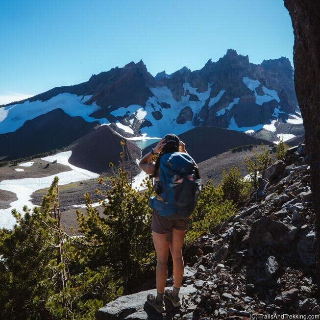
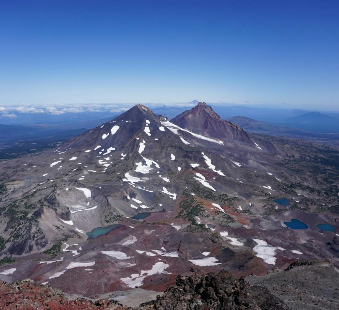
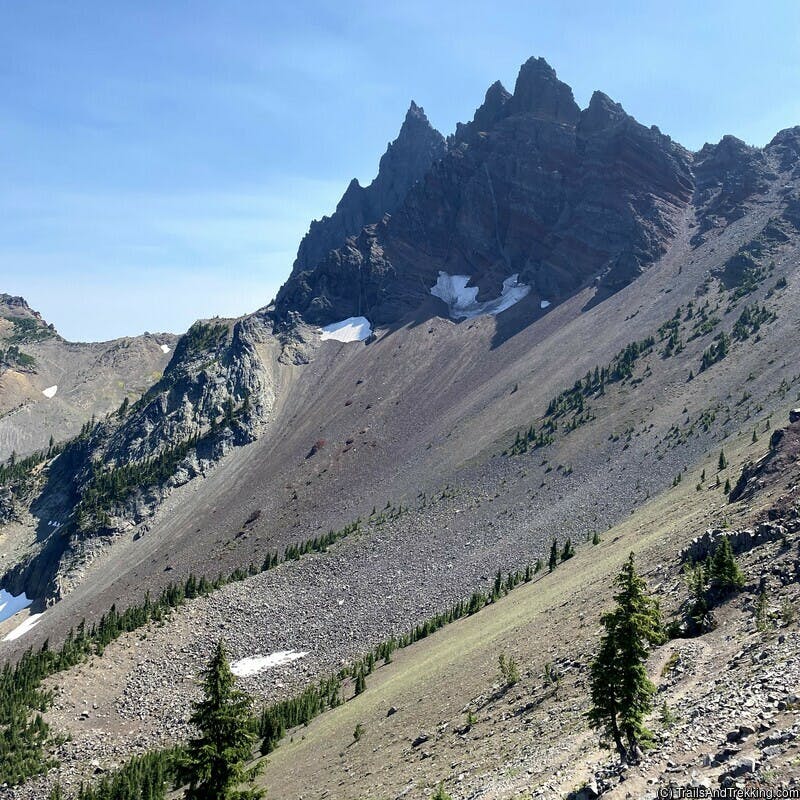
The Obsidian trail is a lollipop loop on the west side of the Three Sisters in Central Oregon's cascades. Expect excellent mountain views of North and Middle Sister on this
trail, and a beautiful bloom seasonal wildflowers. Explore the upper loop
to find fields of obsidian, a waterfall, and a picturesque lake tucked away off-trail.
While doable as a longer day hike, I highly recommend the Obsidian trail for beginner backpackers or for more experienced backpackers looking for a relaxing night out. Read below for a detailed description, and for tips on how to find the secret lake!
While doable as a longer day hike, I highly recommend the Obsidian trail for beginner backpackers or for more experienced backpackers looking for a relaxing night out. Read below for a detailed description, and for tips on how to find the secret lake!


Getting There and Parking
The Obsidian Trail is located off the McKenzie Highway, just below McKenzie Pass on the west side of the central cascades. If you're coming from Sisters, enjoy the scenic but narrow drive
through McKenzie Pass, stopping at the Dee Wright Observatory for mountain and Belknap lava flow views.
Day and overnight visitors to the Obsidian trailhead are required to pre-purchase a Central Cascades Wilderness Permit. Find more information about permits in the section below.
Day and overnight visitors to the Obsidian trailhead are required to pre-purchase a Central Cascades Wilderness Permit. Find more information about permits in the section below.
Hike Details
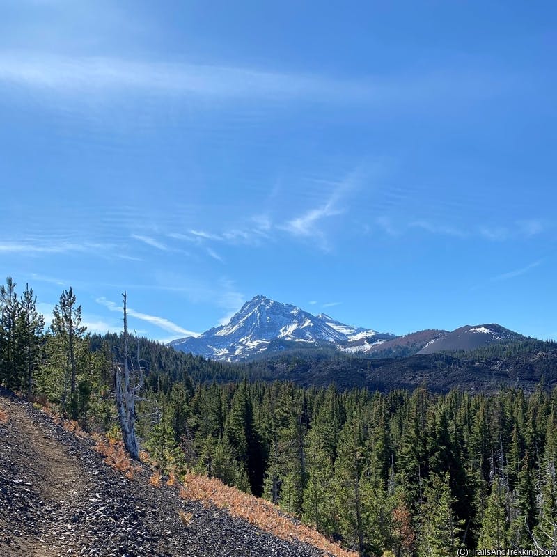
For the first two to three miles, the trail gradually climbs uphill through a dense evergreen forest.
As you climb, the forest begins to open up to meadows, and a rugged lava flow. If you're hiking in July, expect a varied wildflower bloom throughout the meadows.

After about 3.5 miles on the Obsidian Trail, you'll cross a small stream, arriving at the lollipop loop junction. Take a left at the fork to hike the loop clockwise,
following signage for Glacier Way. Hike 0.8 miles on the The Glacier Way trail until it joins with the PCT, turning right on the PCT to continue the loop.
If you're backpacking, the best campsites are on the upper loop off the PCT. After roughly 0.5 miles along the PCT, you'll come to a user trail
that veering left and crossing a stream (Glacier Creek). The wooded area beyond the stream has many amount of campsites along the user trail, and good access to water from the stream.
To find the lake, continue up the user trail, past the campsites in the trees. The trail will exit the trees into a rocky area, with a steep cliff on your right. F
Follow the trail through the rocks for about 0.5 miles, then taking a sharp right to double back towards the cliff you say before. This path follows the sharp U-shaped
line on the map above.
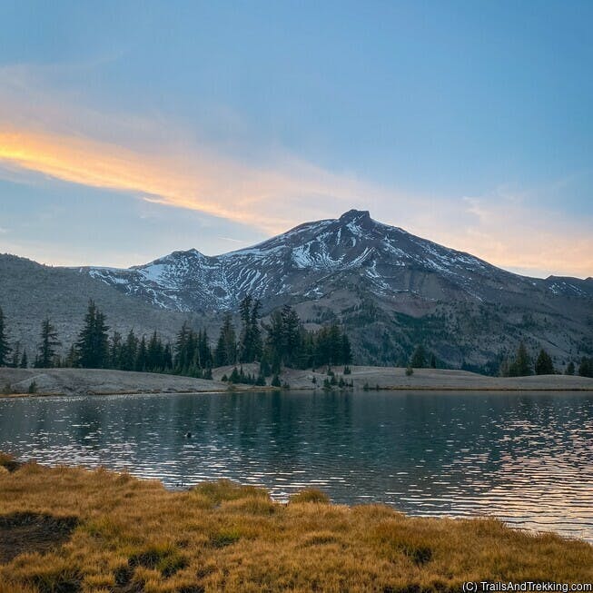
Once you find the small lake, soak in the views of Three Sisters mountains reflected on its glassy surface. There are numerous campsites scattered around the lake,
so you may choose to camp here as well.


To complete the loop, follow the PCT until it meets the Obsidian trail farther down. You'll pass Obsidian Falls and several more wildflower meadows on your way to the main trail.
Once you've rejoined the main trail, it's 3.5 miles on a familiar route back to the parking lot.

Permit Info
Day hikers and backpackers at the Obsidial Trail are required to carry a Overnight Permit or Day Use Ticket at all times in the Three Sisters wilderness. Permits must be purchased online prior to the date of your trip.
The Three Sisters permit season runs from June 15th to October 15th, becoming highly competitive during peak summer months. 40% of overnight permits are released on April 4th, at 7AM PDT , and another 60% are released on a 7-day rolling window from June through October. Day use permits are additionally released on 10-day and 2-day rolling windows, allowing the possibility of snagging a permit shortly before a day trip.
All permits are reservable on a first-come, first-served basis. To increase your odds of getting a permit, log into recreation.gov by 7AM the week before you want to backpack, and select your desired trailhead as soon as it becomes available. Permits sell out quickly for popular trailheads!
You may hike without a permit before June 15th or after October 15th, but please be prepared for the possibly of deep snow and difficult or dangerous weather conditions.

What to Pack
Backpacks
Shelter
- backpacking tent
- sleeping bag
- sleeping mat (women's), sleeping mat (men's)
- pillow
- tent lights

Camp Kitchen
- kitchen kit
- electric lighter
- spork
- pocket-knife
- water bottle
- squeeze filter bottle
- water filter
- un-flavored, un-sweetned electrolyte solution
- bear can
- ursack (bear bag)
- tasty camp dinner
- easy no-mess camp breakfast (discount code LAURENG for 15% off)

Toiletries
- Tooth brush
- Floss
- tooth paste tabs
- body & face wipes
- bug spray
- the BEST itch relief solution (I literally carry this everywhere during bug season)
- first aid kit

Utilities
- headlamp
- portable battery
- kindle e-reader
- Garmin GPS watch
- dry bag, stuff sack
- the best trail maps (better than Nat Geo's)

Clothing
- hiking boots (women's)
- trail shoes (men's)
- camp shoes
- hiking socks
- packable puffer
- women's hiking shorts
- men's hiking shorts
- women's hiking pants
- men's hiking pants (6'0ft+ friendly!)
Still have questions? Send me a message over email to connect. Happy Trails!