LENGTH
24 mile loop
ELEVATION
2,400 feet
DIFFICULTY
Very hard
SEASON
Summer through fall
PERMITS
Central Cascades Overnight Permit, Northwest Forest Pass
TRAILHEAD

Looking for a challenging, but highly rewarding multi-day backpacking trip in Oregon? The Broken Top loop showcases some of Central Oregon's best scenery,
packed with alpine meadows, lakes, and exceptional views of the surrounding cascade peaks. Hike in mid summer for the best wildflower display,
typically in peak bloom by mid to late July.
This isn't an easy hike due to numerous trail hazards - If you can conquer the downed trees and rocky slopes of scree, you'll be treated to an absolutely beautiful, one of a kind adventure.
This isn't an easy hike due to numerous trail hazards - If you can conquer the downed trees and rocky slopes of scree, you'll be treated to an absolutely beautiful, one of a kind adventure.


Getting There and Parking
The Broken Top Loop is best started from the Tam McArthur Rim Trailhead, at Three Creek Lake. The gravel road to Three Creek Lake was rebuilt in 2023, and should be passable to all vehicles. Note that Three Creek Lake is also a popular recreation
area for camping, fishing, and day hiking.
Make sure to bring your NW Forest Pass for parking at the trailhead, in addition to a Central Cascades Permit for camping within the wilderness boundary.
Note that you may start this hike from other trailheads, such as Park Meadows, Todd Lake, or Green Lake. Be prepared for a longer, more difficult loop if starting from another point.
Hike Details
I recommend hiking the loop clockwise, starting from the Tam McArthur Rim Trailhead. This lets you spread the mileage out more evenly, allowing access to the best campsites.
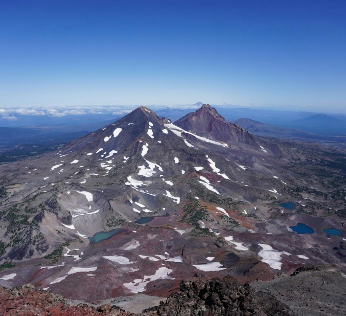
From the Tam McArthur Rim Trailhead, the trail begins climbing steeply along the ridge towards Broken Top. Gradually, the trees thin out, and you'll be treated with several viewpoints of the Three Sisters and fields of wildflowers.
From the Tam McArthur Rim Trailhead, the trail begins climbing steeply along the ridge towards Broken Top. Gradually, the trees thin out, and you'll be treated with several viewpoints of the Three Sisters and fields of wildflowers.

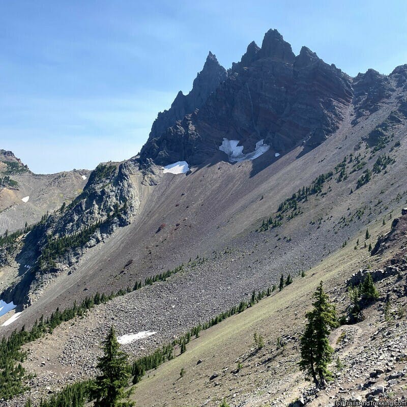
After about 4.6 miles of hiking up the rim, you'll arrive at a large spire of rock known as Broken Hand. This one of the main obstacles on the trail, and can be very difficult to navigate early in the season.
Expect a very narrow trail of loose rock, with a sharp drop off on one side. The right-hand path is easier to cross once the snow has melted off.
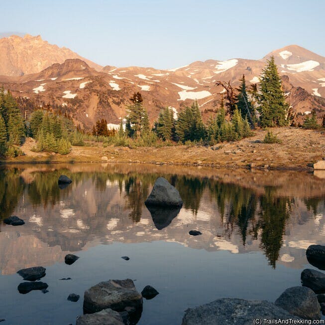
Once past Broken Hand, you'll get a glimpse of No Name Lake's cloudy blue water, nestled in a cirque below Broken Top. The coloration comes from rock flour deposited by melting snow. Carefully make your way down to No Name Lake - this will be slow going due to the steep, rocky nature of the trail.
Once past Broken Hand, you'll get a glimpse of No Name Lake's cloudy blue water, nestled in a cirque below Broken Top. The coloration comes from rock flour deposited by melting snow. Carefully make your way down to No Name Lake - this will be slow going due to the steep, rocky nature of the trail.

Camping is prohibited within 1/4 of No Name Lake, but you'll find plenty of campsites beyond the boundary tucked into groups of trees off trail.
I suggest camping somewhere between the No Name Lake camping boundary and Soda Creek Meadows further below. You shouldn't have trouble finding a suitable campsite in this area,
and there are nearby creeks to draw water from year-round. Soda Creek Meadows has an exceptional wildflower bloom in July, among the most beautiful on the entire Broken Top Loop.

Hiking from Soda Creek Meadows, the next main destination is Green Lakes - a beautiful lake basin nestled between South Sister and Broken Top
that's very popular with backpackers and day hikers. Note that Green Lakes is about 6 miles from No Name Lake along the Broken Top trail,
and has 22 designated campsites. When camping at Green Lakes, you are required to setup your tent within 15' of a marked camping stake.

Continue the loop by heading north on the Green Lakes trail, staying along the right-hand side of the lake. The trail gently rises to a ridge, before descending to Golden Lake.
From Green Lakes, it's 3.5 miles in total to Golden Lake. Expect wildflowers and beautiful mountain views in this section.

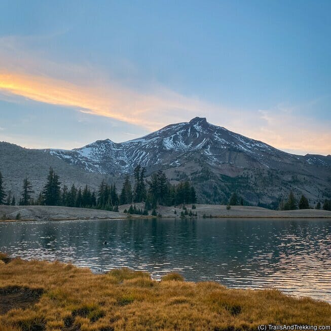
When approaching Golden Lake, keep an eye out for the cutoff trail, which is easy to miss. The cutoff to Golden Lake will be on your right-hand side,
and is unmarked. By the cutoff trail, it's about 0.5 miles further to Golden Lake - a remarkable, remote spot in the Three Sisters Wilderness that feels
almost untouched by humans. Broken Top towers prominently behind the small lake, giving an impressive backdrop to the beautiful scene. Search the outskirts of the lake to find campsites,
remembering that camping is prohibited within 250' of the lake. There are about 5 established campsites here, northeast and northwest of the lake.

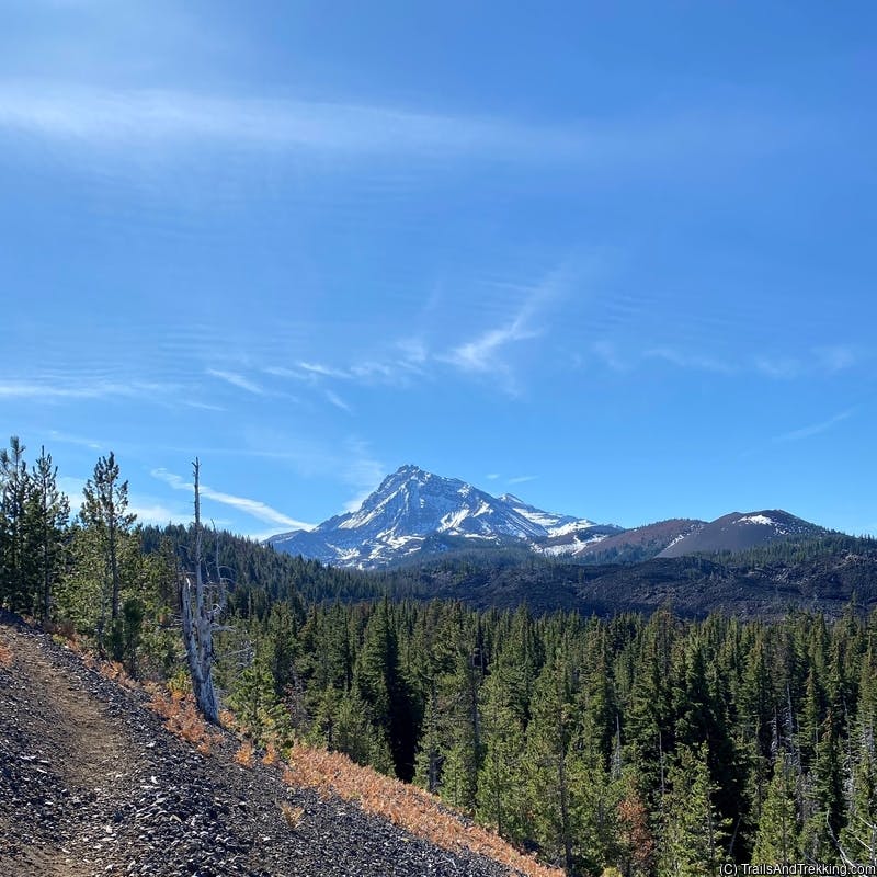
The section of trail beyond Golden Lake is extremely challenging. Be prepared for intense blow down spanning almost 9 miles, from Golden Lake to Three Creek Lake.
Shortly after leaving the meadows near Golden Lake, the forest transitions to a severe burn with almost no shade. This is the most difficult part of the hike, navigating around
and climbing over innumerable fallen trees. A severe windstorm felled many trees in the winter of 2022, and the trail is currently unmaintained (as of summer 2023).
Keep your patience on this section, take plenty of breaks at stream crossings, and slowly make your way back to Three Creek Lake. Follow the Green Lakes Trail, turning right onto the Park Meadow Trail. After 3 miles on the Park Meadow Trail, turn right at the 4-way junction for the Park Meadow Tie. From here, its about 3 miles further to Three Creek Lake, where you'll wrap up the loop.
Keep your patience on this section, take plenty of breaks at stream crossings, and slowly make your way back to Three Creek Lake. Follow the Green Lakes Trail, turning right onto the Park Meadow Trail. After 3 miles on the Park Meadow Trail, turn right at the 4-way junction for the Park Meadow Tie. From here, its about 3 miles further to Three Creek Lake, where you'll wrap up the loop.

Permit Info
Day hikers and backpackers at Broken Top are required to carry a Overnight Permit or Day Use Ticket at all times in the Three Sisters wilderness. Permits must be purchased online prior to the date of your trip.
The Three Sisters permit season runs from June 15th to October 15th, becoming highly competitive during peak summer months. 40% of overnight permits are released on April 4th, at 7AM PDT , and another 60% are released on a 7-day rolling window from June through October. Day use permits are additionally released on 10-day and 2-day rolling windows, allowing the possibility of snagging a permit shortly before a day trip.
All permits are reservable on a first-come, first-served basis. To increase your odds of getting a permit, log into recreation.gov by 7AM the week before you want to backpack, and select your desired trailhead as soon as it becomes available. Permits sell out quickly for popular trailheads!
You may hike without a permit before June 15th or after October 15th, but please be prepared for the possibly of deep snow and difficult or dangerous weather conditions.

What to Pack
Backpacks
Shelter
- backpacking tent
- sleeping bag
- sleeping mat (women's), sleeping mat (men's)
- pillow
- tent lights

Camp Kitchen
- kitchen kit
- electric lighter
- spork
- pocket-knife
- water bottle
- squeeze filter bottle
- water filter
- un-flavored, un-sweetned electrolyte solution
- bear can
- ursack (bear bag)
- tasty camp dinner
- easy no-mess camp breakfast (discount code LAURENG for 15% off)

Toiletries
- Tooth brush
- Floss
- tooth paste tabs
- body & face wipes
- bug spray
- the BEST itch relief solution (I literally carry this everywhere during bug season)
- first aid kit

Utilities
- headlamp
- portable battery
- kindle e-reader
- Garmin GPS watch
- dry bag, stuff sack
- the best trail maps (better than Nat Geo's)

Clothing
- hiking boots (women's)
- trail shoes (men's)
- camp shoes
- hiking socks
- packable puffer
- women's hiking shorts
- men's hiking shorts
- women's hiking pants
- men's hiking pants (6'0ft+ friendly!)
Still have questions? Send me a message over email to connect. Happy Trails!